Utente:LiaFla/Sandbox 1
Vai alla navigazione
Vai alla ricerca
Bonaire[modifica | modifica wikitesto]
| Article | description | Place | data di inizio | data di fine | coordinate geografiche | immagine |
|---|---|---|---|---|---|---|
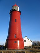
| Boca Spelonk Lighthouse | Bonaire | 12.212222°N 68.196667°W |  | |||
| Ceru Bentana. Lighthouse | Bonaire | 12.305°N 68.376111°W |  | |||
| Kralendijk Lighthouse | Bonaire Kralendijk |
12.148806°N 68.276806°W 12.148889°N 68.276667°W |
 | |||
| Lacre Punt Lighthouse | Bonaire | 12.028°N 68.238°W |  | |||
| Malmok Lighthouse | Bonaire | 12.311313°N 68.392268°W |  |
Delfzijl[modifica | modifica wikitesto]
| Article | description | Place | data di inizio | data di fine | coordinate geografiche | immagine |
|---|---|---|---|---|---|---|
| Delfzijl Lighthouse (1888) | Delfzijl | 53.332778°N 6.923889°E | ||||
| Delfzijl Lighthouse (1949) | Delfzijl | 53.33278°N 6.92389°E | ||||
| Watum Lighthouse | Delfzijl | 53.374894°N 6.889736°E |  |
Enkhuizen[modifica | modifica wikitesto]
| Article | description | Place | data di inizio | data di fine | coordinate geografiche | immagine |
|---|---|---|---|---|---|---|
| De Ven | Enkhuizen | 52.741944°N 5.282222°E |  | |||
| harbour entrance light of Enkhuizen | Enkhuizen | 52.699372°N 5.293064°E |  |
Goeree-Overflakkee[modifica | modifica wikitesto]
| Article | description | Place | data di inizio | data di fine | coordinate geografiche | immagine |
|---|---|---|---|---|---|---|
| Toren van Goedereede | Goeree-Overflakkee | 51.818415°N 3.975756°E |  | |||
| Vuurtoren aan het Flaauwe Werk | Goeree-Overflakkee | 51.829389°N 3.929083°E | ||||
| Westhoofd Lighthouse | Goeree-Overflakkee | 51.813197°N 3.864133°E |  |
Korendijk[modifica | modifica wikitesto]
| Article | description | Place | data di inizio | data di fine | coordinate geografiche | immagine |
|---|---|---|---|---|---|---|
| Nieuwendijk Range Front | Korendijk | 51.750817°N 4.3232°E | ||||
| Nieuwendijk Range Rear | Korendijk | 51.753067°N 4.317717°E |  |
L'Aia[modifica | modifica wikitesto]
| Article | description | Place | data di inizio | data di fine | coordinate geografiche | immagine |
|---|---|---|---|---|---|---|
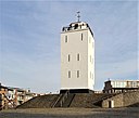
| Faro di Scheveningen | L'Aia | 52.104128°N 4.268244°E |  | |||
| Scheveningen North Mole Light | L'Aia | 52.10401°N 4.256322°E |  | |||
| Scheveningen Pier Light | L'Aia | 52.117833°N 4.279833°E |  | |||
| Scheveningen South Mole Light | L'Aia | 52.103563°N 4.253482°E |  |
Rotterdam[modifica | modifica wikitesto]
Schiermonnikoog[modifica | modifica wikitesto]
| Article | description | Place | data di inizio | data di fine | coordinate geografiche | immagine |
|---|---|---|---|---|---|---|
| North Tower | Schiermonnikoog | 53.486839°N 6.146525°E |  | |||
| Zuidertoren | Schiermonnikoog | 53.483333°N 6.166667°E |  |
Schouwen-Duiveland[modifica | modifica wikitesto]
| Article | description | Place | data di inizio | data di fine | coordinate geografiche | immagine |
|---|---|---|---|---|---|---|
| Hoge vuurtoren van Noord-Schouwen | Schouwen-Duiveland | 51.741639°N 3.795417°E | ||||
| Lage vuurtoren van Noord-Schouwen | Schouwen-Duiveland | 51.742417°N 3.783333°E | ||||
| Verklikkerlicht | Schouwen-Duiveland | 51.72525°N 3.705167°E |  | |||
| Westerlichttoren | Schouwen-Duiveland | 51.708889°N 3.691667°E |  |
Súdwest-Fryslân[modifica | modifica wikitesto]
| Article | description | Place | data di inizio | data di fine | coordinate geografiche | immagine |
|---|---|---|---|---|---|---|
| Faro di Stavoren | Súdwest-Fryslân | 52.88804°N 5.35761°E |  | |||
| Stavoren North Pierhead Light | Súdwest-Fryslân | 52.88634°N 5.352343°E |  | |||
| Stavoren South Pierhead Light | Súdwest-Fryslân | 52.88592°N 5.35378°E |  | |||
| Workum Lighthouse | Súdwest-Fryslân | 52.960228°N 5.412133°E 52.96024°N 5.4122°E |
 |
Veere[modifica | modifica wikitesto]
| Article | description | Place | data di inizio | data di fine | coordinate geografiche | immagine |
|---|---|---|---|---|---|---|
| Faro basso di Westkapelle | Veere | 51.54°N 3.436667°E |  | |||
| Kaapduinen front lighthouse | Veere | 51.4745°N 3.516333°E |  | |||
| Kaapduinen rear lighthouse | Veere | 51.473233°N 3.518817°E |  | |||
| Lichtopstand Zoutelande | Veere | 51.50453°N 3.47351°E |  | |||
| Westkapelle Hoog | Veere | 51.529167°N 3.446944°E |  |
Velsen[modifica | modifica wikitesto]
| Article | description | Place | data di inizio | data di fine | coordinate geografiche | immagine |
|---|---|---|---|---|---|---|
| faro alto di IJmuiden | Velsen | 52.460825°N 4.582806°E |  | |||
| faro basso di IJmuiden | Velsen | 52.461758°N 4.574522°E |  |
Voorne aan Zee[modifica | modifica wikitesto]
| Article | description | Place | data di inizio | data di fine | coordinate geografiche | immagine |
|---|---|---|---|---|---|---|
| Hellevoetsluis Lighthouse | Voorne aan Zee | 51.819722°N 4.127778°E |  | |||
| Lighthouse of Oostvoorne | Voorne aan Zee | 51.91862°N 4.09492°E 51.919972°N 4.095669°E |
 | |||
| Stenen Baak | Voorne aan Zee | 51.927694°N 4.140694°E |  |


